
CANADA
Paddling the Northern Forest
Northern Forest
Canoe Trail
Northern Forest
Canoe Trail
CANADA
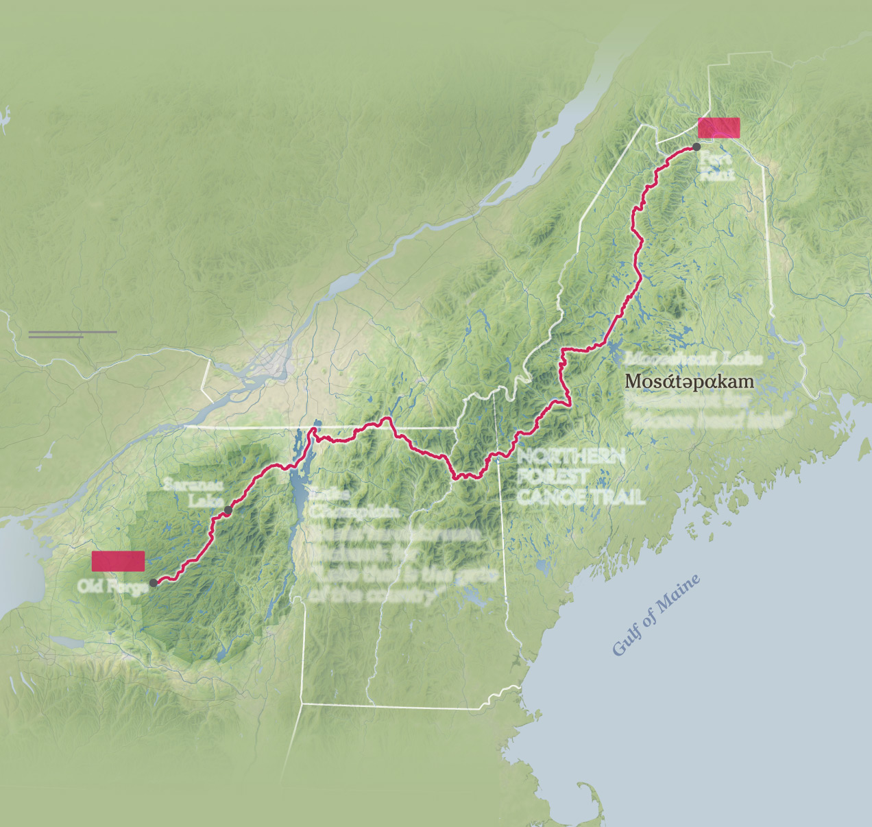
Two-plus decades ago, a group of paddlers and hikers
hatched a bold plan to create the Appalachian Trail of
canoeing. Backed by federal grants, they mapped the
740-mile Northern Forest Canoe Trail (NFCT), which runs
from New York to Maine. Inspired by waterways long
used by Indigenous communities for trade, the route
flows through small towns and rugged backcountry.
N
UNITED
STATES
MAP
AREA
UNITED
STATES
CANADA
united states
NEW
BRUNSWICK
Cross-country
The NFCT wends into
Canada for roughly
29 miles. All paddlers
must stop to show
their passport when
crossing the border.
Fort
Kent
END
Montréal
CANADA
CANADA
U.S.
QuÉbec
U.S.
Swanton
Clayburg
Adirondack
Park
Mud Pond
Lake
Champlain
Following Thoreau
Old Forge
Moosehead
Lake
START
Famous for perplexing
Henry David Thoreau
on a trip in 1857, the
rocky Mud Pond carry
offers travelers one
final challenge.
VERMONT
Rapid R.
Fulton Chain
Lakes
Kania’tarakà:ronte
Mohawk for
“Lake that is the gate
of the country”
Penobscot for
“Moose head lake”
New York
New
HampSHIRE
Maine
Carrying on
Shoving off
Go with the flow
The trail requires 65
portages, during which
travelers must carry
their canoes around
rapids, waterfalls, or to
the next body of water.
The NFCT starts high
in the Adirondacks on
the Fulton Chain Lakes
before descending 1,400
feet over 144 miles to
Lake Champlain.
The aptly named
Rapid River is one of
several spots where
canoers can enjoy
thrilling sections of
whitewater.
Rosemary Wardley, NGM Staff.
Sources: James Francis, Penobscot Nation; Darren Bonaparte, Saint Regis Mohawk
Tribe; Northern Forest Canoe Trail; Natural Earth; Openstreetmap; USGS;
NASA MODIS; NASA SRTM
Paddling the Northern Forest
Two-plus decades ago, a group of paddlers and hikers
hatched a bold plan to create the Appalachian Trail of
canoeing. Backed by federal grants, they mapped
the 740-mile Northern Forest Canoe Trail (NFCT),
which runs from New York to Maine. Inspired
by waterways long used by Indigenous
communities for trade, the route
flows through small towns and
rugged backcountry.
NEW
BRUNSWICK
END
Fort
Kent
CANADA
U.S.
Maine
50 mi
QuÉbeC
50 km
Moosehead Lake
Penobscot for
“Moose head lake”
ONTARIO
CANADA
U.S.
Northern
Forest
Canoe Trail
VERMONT
Adirondack
Park
Saranac
Lake
Lake
Champlain
Adirondack
Park
Kania’tarakà:ronte
Mohawk for
“Lake that is the gate
of the country”
START
Old Forge
New York
New
HampSHIRE
Rosemary Wardley, NGM Staff.
Sources: James Francis, Penobscot Nation; Darren Bonaparte, Saint Regis Mohawk
Tribe; Northern Forest Canoe Trail; Natural Earth; Openstreetmap; USGS;
NASA MODIS; NASA SRTM
R.I.
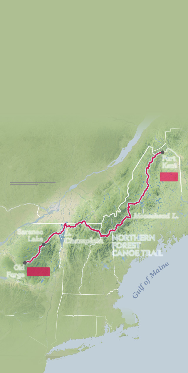
Paddling the
Northern Forest
Two-plus decades ago, a group of
paddlers and hikers hatched a bold
plan to create the Appalachian Trail of
canoeing. Backed by federal grants,
they mapped the 740-mile Northern
Forest Canoe Trail (NFCT), which runs
from New York to Maine. Inspired by
waterways long used by Indigenous
communities for trade, the route
flows through small towns
and rugged backcountry.
N.B.
Fort
Kent
END
100 mi
100 km
quÉBec
ONT.
Moosehead L.
CANADA
Maine
U.S.
Saranac
Lake
L.
Champlain
Northern
Forest
Canoe Trail
VERMONT
Old
Forge
START
New
HampSHIRE
New York
Mass.
Rosemary Wardley, NGM Staff.
Sources: James Francis, Penobscot
Nation; Darren Bonaparte, Saint Regis
Mohawk Tribe; Northern Forest Canoe
Trail; Natural Earth; Openstreetmap;
USGS; NASA MODIS; NASA SRTM